A watershed is an area of land that captures water and drains it to a common water body such as a stream, river, lake, bay, or the ocean. A watershed boundary is the divide separating one drainage area from another. Watersheds come in all shapes and sizes and are nested at different scales depending on where the point of converging flows is located. Terms like catchment, sub watershed, sub basin and basin are also nomenclatures used to describe watersheds of various sizes. The word basin is used to describe the largest type of watershed that is typically under the planning authority of the state or federal government because it drains land beyond local government boundaries.
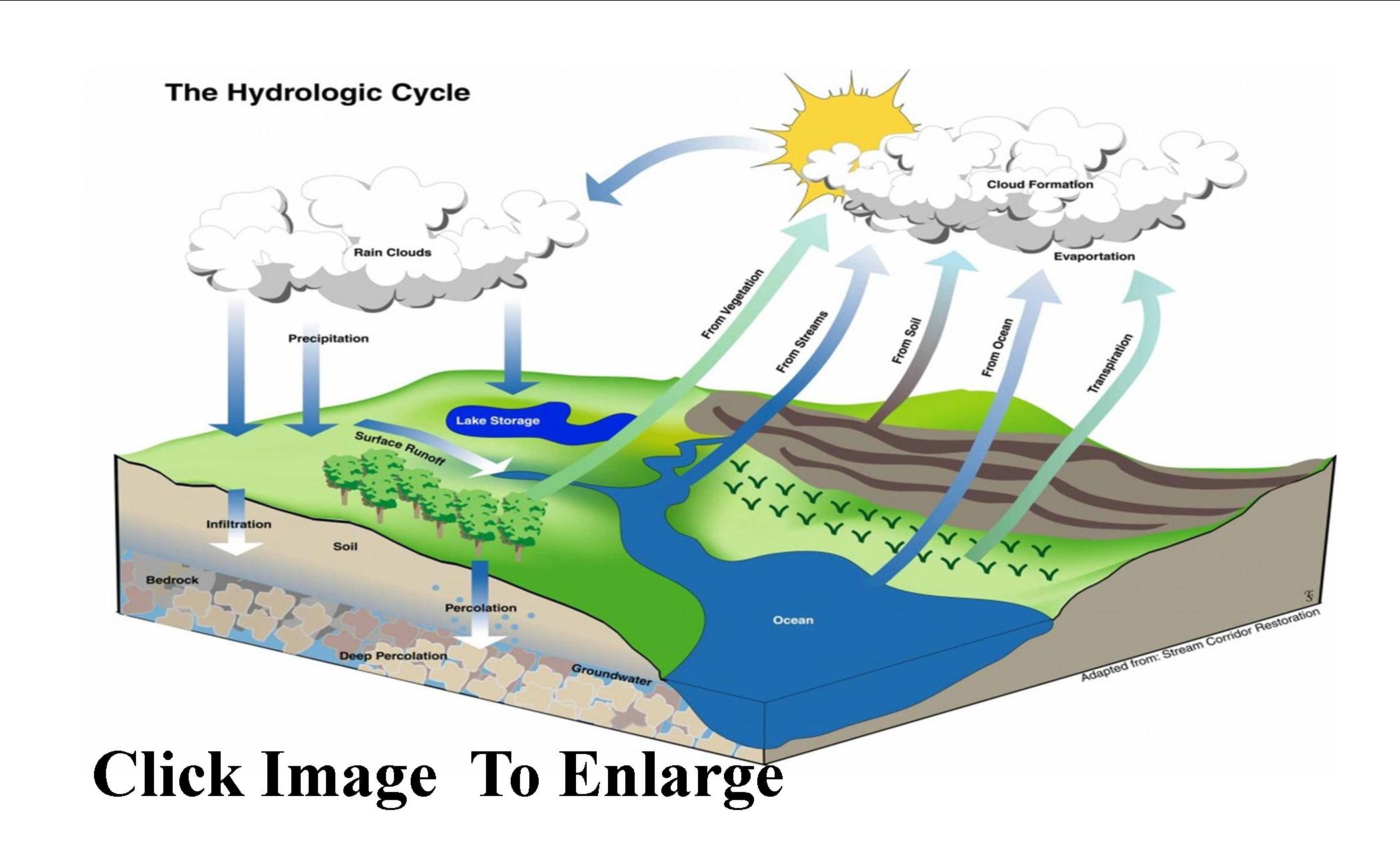
How a watershed is shaped, land use within the watershed, weather, and many other factors affect how it drains, where flooding occurs, and water quality. The graphic below shows how water moves through watersheds. This process is called the hydrologic cycle.
Portions of several major watersheds (basins) lie partially within Lee County; the Everglades West Coast Basin, the Caloosahatchee River and Estuary Basin and the Charlotte Harbor Basin.
For more information about these watersheds, please visit the following links:
Our Water Story – Lee County's Water Initiative
Everglades West Coast Basin
Caloosahatchee River and Estuary
Charlotte Harbor