Charlotte Harbor is America's 17th largest estuary and Florida's second largest open-water estuary. It is semi-enclosed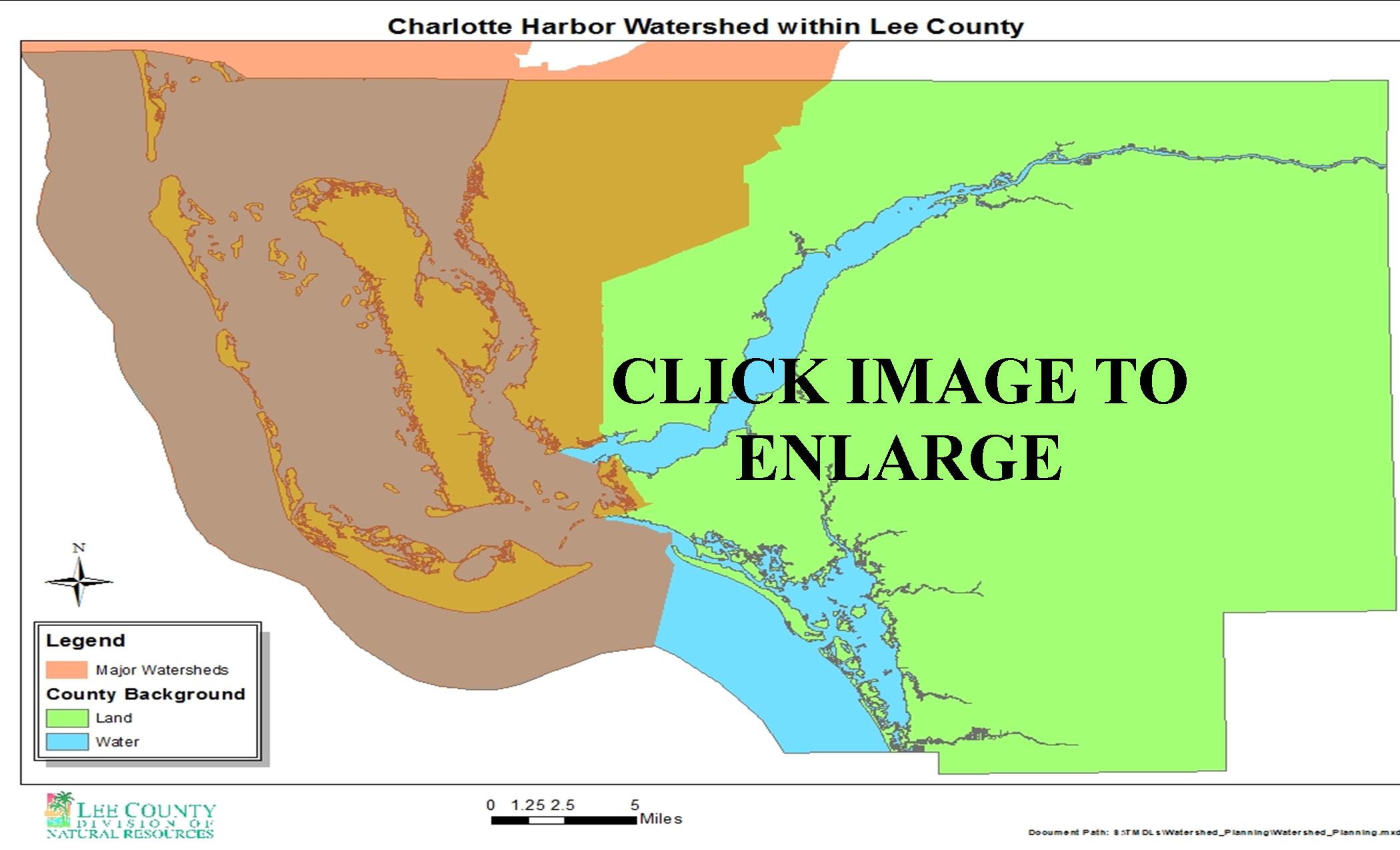 by Cape Haze and the barrier islands of Gasparilla, Boca Grande, Cayo Costa, Captiva and Sanibel on the western side of the harbor and inland masses that make up Sarasota, Charlotte and Lee counties on the eastern side of the harbor. The harbor opens to the Gulf of Mexico through several tidal inlets between the barrier islands. Its open-water surface area is about 270 square miles (Charlotte Harbor National Estuary Program [CHNEP], 1998) and averages 7 feet in depth (Stoker, 1992).
The drainage basin stretches from the headwaters of the Peace River in Polk County, southward through San Carlos Bay near Fort Myers, and eastward to Lake Okeechobee, encompassing eight counties and 4,670 square miles (Stoker, 1992). Charlotte Harbor receives its fresh water from three major rivers and several smaller streams that mix with the marine waters of the Gulf of Mexico. The salinity can range from freshwater to seawater depending on the season, location and depth in the harbor.
The Charlotte Harbor region is home to five national wildlife refuges, five state aquatic preserves, and one state buffer preserve. The region supports a great diversity of semitropical plant and animal life. In 1990, 86 federal and state protected plant and animal species were found. In 1995, Charlotte Harbor was recognized as an "estuary of national significance" and was accepted into the National Estuary Program. The CHNEP study area, at 4,400 square miles, differs slightly from the 4,670 square-mile drainage basin depicted by the U.S. Geological Survey (USGS) (Stoker, 1992). The study area adds the Estero, Lemon, Dona, and Roberts Bay watersheds but does not include the non-tidal portions of the Caloosahatchee River watershed between Franklin Lock and Lake Okeechobee.