Task 2 - Identiication of Improvements
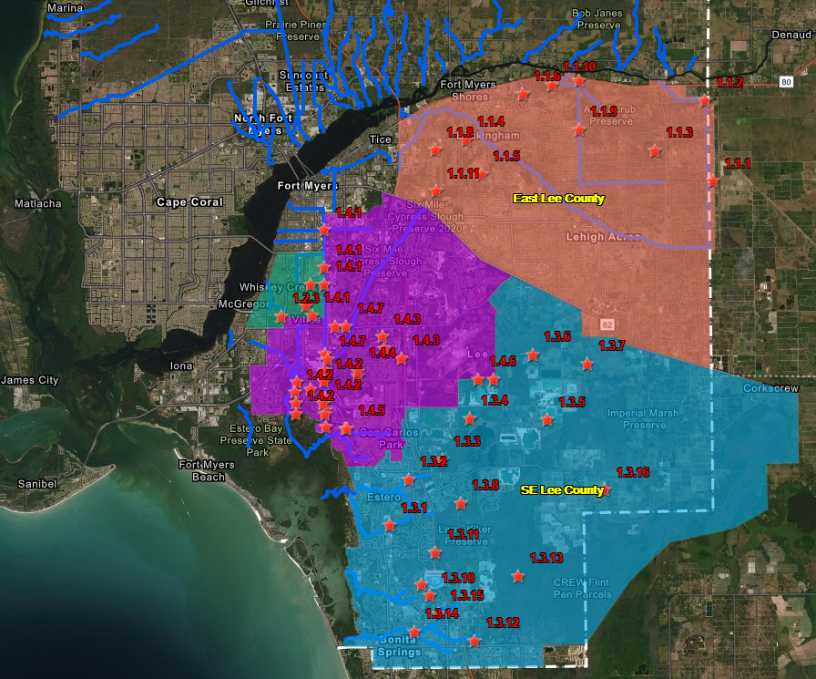
A total of 37 potential flood mitigation projects were identified through review of existing flood condition documents (including the Phase 2 report), studies, and post-Hurricane Irma flood photographs; interviewing local officials for flooding impacts in their relative areas; analysis of the watershed for potential concept projects for improving floodway conveyance and flood water storage components.
The concept projects below aimed to provide a network system of high-functioning conveyances and water control structures. This effort sets a ‘benchmark’ for comprehensive flood control needs on a regional basis and provides a ‘measuring stick’ as the County works towards regional flood mitigation improvements. While the viability of each concept is addressed at a high level using metrics of cost, environmental permitability, etc., each concept’s ability to mitigate flooding is the primary driver. The flood mitigation concepts are only intended to utilize the high-capacity conveyance functionality during severe storm events and not alter normal seasonal flows or hydroperiods.
Click map below to load an interactive map